Routes and Itineraries
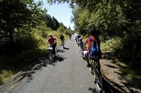
Two-wheeled adventures for all ages and all abilities in East Multnomah County await (or one-wheeled, three-wheeled, or however many wheels you have and can pedal, kick, or push).
What Am I Getting Into? - Click here for Ride Rating Categories
Springwater Corridor Trail
Difficulty level - Mild
Route details
Discover natural wonders along this historic trolley line. Bring a bucket and pick berries. Poke into Historic Downtown Gresham's many shops, cafes, and restaurants, straight up the hill from Main City Park. Go all the way to Boring. Restrooms and water are available at Linneman Station, Main City Park, and Boring Station Trailhead. For additional route information, click here. Click here for a list and map of downtown Gresham businesses.

Larch Mountain Road
Difficulty level - Challenging to Extreme
Route details
See East Multnomah County from its highest point, but you'll have to work to get there. At least 20 miles of steady climbing, this route provides great rewards even if you don't make it the whole way. The pedal-free down is worth all the effort. Click here for information about Troutdale dining.

Larch Mountain Trail
Difficult level - Extreme
Route details
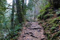
The Larch Mountain Trail is for accomplished mountain bike riders. Test your skills on this epic ride. Six plus miles of trail wrap around the Larch Mountain crater taking you down over roots, rocks, and washes. Not just a downhill ride, a formidable uphill separates the wheat from the chaff. For additional route information, click here. For information about Troutdale dining, click here.


